the Connecticut Map Society
Dedicated to the study and appreciation of maps, with a special emphasis on Connecticut cartography
about the society
The Connecticut Map Society was founded in 2017 by three map enthusiasts: Connie Brown, Brian Tims, and Maryann Ott. The purpose of the Connecticut Map Society, a non-profit corporation, is to promote the study of cartography and its history, to encourage map collecting, and to support the preservation of the world’s cartographic heritage. Membership is open to everyone and includes collectors, dealers, curators, academics, cartographers, and those who simply enjoy maps.
We believe in the potential and power of maps to touch us and communicate about our world in ways that only the cartographic image can achieve. Our interests include, but are not limited to, cartographic history, the role of maps in exploration and discovery, maps as art, the intersection of maps and technology, global and political maps and contemporary mapping practices.
We come together about six times a year. Our events are held at various locations around the state of Connecticut, and are an opportunity for members to enjoy presentations by a wide variety of speakers, scholars, collectors, curators and creators of maps. On occasion, arrangements are made for special field trips to view private map collections, museum shows, gallery exhibitions, special lectures, and map-related events.
If you love maps, want to learn more about them, and want to meet others who share a similar passion, we encourage you to join the Connecticut Map Society!
Meet our founders:
Brian Tims, our President, is an attorney who enjoys collecting and researching antique maps (and globes, too). His areas of interest include nautical maps of Long Island Sound, early maps of Connecticut, and bird’s eye views of New England.
Connie Brown, our Vice-President, makes hand-painted custom canvas wall maps for individuals, organizations, and companies. She is interested in all kinds of mapping, historical and current.
Maryann Ott, our Treasurer, is a visual artist who often uses maps in the creation of one-of-a-kind works of hand-colored photography, collage, and ephemera. As an amateur astronomer, she is especially interested in celestial maps.
membership
We welcome you to join the Connecticut Map Society. As we are a volunteer organization, your membership dues directly support the honoraria paid to our presenters, the administration and hosting of our website, and meeting related expenses.
We currently offer three membership levels, with dues paid annually:
Student Members ($25) join us at a discounted membership rate and are welcome at all events.
Basic Members ($35) are welcome at all events and their dues help cover our administrative costs.
Sustaining Members ($75) are those who provide the Connecticut Map Society with additional resources to bring high-profile speakers to our events. We thank our Sustaining Members: Frank Cochran, David Grigsby, Paul Lombroso and Jan Naegele.
Charter Members are the generous, early supporters of our mission. We thank our Charter Members: Connie Brown, Neil Currie, Ron Gagliardi, Steve Hanon, Peter Herbst, Hazel Jarvis, Andrew Kapochunas, Barbara Lamb, Duncan Milne, David Moulton, Maryann Ott, Deborah Shapiro, Brian Tims, and Johan (Joop) Varekamp.
Time to RENEW your membership? Just mail a check to Connecticut Map Society, 67 Jaenicke Lane, Hamden, CT 06517, or bring a check to the next event.
upcoming events
Edwin Howell: Mapping Early Explorations of the American West
When: Saturday, May 10th, 2pm
Where: Wesleyan University, Middletown CT (Earth & Environmental Sciences Department, Exley Science Center, Church/Pine Street, 4th floor, room 405)
Ellen Thomas and Joop Varekamp, curators of the Joe Webb Peoples Museum of Natural History at Wesleyan, will enlighten us about Edwin Howell and his maps, within the context of the early explorations of the American West. We will look at some of the relief maps on display at Wesleyan, notably the Grand Canyon Map by Howell, as well as an 1894 curved relief map of the geology of the U.S. Other relief maps and models of volcanoes can also be inspected. We will look at some geological maps of the western U.S. with associated photographs.
Edwin E. Howell (1845-1911) was a geologist and cartographer . Howell worked for the U.S. Geological Survey, and travelled in the West with John Wesley Powell during his Rocky Mountain Expedition in 1874. Powell published his ‘Report of the Exploration of the Colorado River of the West and Its Tributaries’ in 1875, the same year that Howell made his famous Grand Canyon relief map, based on the information gathered by Powell, and exhibited at the 1876 Centennial Exhibition in Philadelphia. Howell also made many detailed regular geological maps, as well as a historic relief model of Yellowstone (1897), which helped the public understand the human relationship to the geology.
Manuscript Mapmaking 101: A Workshop
When: Saturday, May 31st, 2-4 pm
Where: Mitchell Library (the New Haven Public Library’s Westville branch), 37 Harrison Street, New Haven CT 06515 (parking is available next to the library)
Cartographer and Connecticut Map Society founder and board member Connie Brown will share techniques for creating your own hand-drawn maps. Is there a place or a trip you’d like to map? Your childhood home, a family migration, a journey you’d like to commemorate cartographically? Bring a commercial paper map, laptop, or iPad for reference—or skip the research and make a memory map. Materials provided.
You must pre-register for this workshop: email connie@redstonestudios.com. Sign up soon: there are only 20 spots.
Field Trip to Whitlock Book Barn
When: Sunday, June 22nd, 2pm
Where: 20 Sperry Road, Bethany, CT 06524
A Connecticut treasure, Whitlock’s Book Barn has been in business since 1948. In its two red barns, you’ll find hundreds of used books and maps. Because map lovers tend to be book lovers, we think this field trip is for you. Store Manager Meg Turner will preside, describing the store’s history and showing us a selection of maps from the collection. Thereafter, you’re free to browse their maps and books.
past events
February 1, 2025 – “Antique Map Collecting 101: Foxing, soiling, and worm holes, oh my!”, by President Brian Tims, at the Avon Free Public Library
December 6, 2024 – Annual Show & Tell Event, Hamden
October 13, 2024 – “Antique Map Collecting 101: Foxing, soiling, and worm holes, oh my!”, by President Brian Tims, at the South Windsor Library
December 1, 2023 – Annual Show & Tell Event, New Haven
May 20, 2023 – Guided Tour of Yale Gallery’s exhibit entitled “Crafting Worldviews: Art and Science in Europe, 1500-1800, New Haven
December 2, 2022 – Annual Show & Tell Event, New Haven
October 15, 2022 – Guided Tour of “The World in Maps, 1400–1600” at Yale’s Beinecke Rare Book & Manuscript Library, New Haven
December 6, 2019 – Annual Show & Tell Event, Middlefield
November 9, 2019 -Guided Tour of “War, Maps, Mystery: Dutch Mapmaker Bernard Romans and the American Revolution” at The Connecticut Historical Society, Hartford
October 26, 2019 – “Frames that Speak: An Introduction to Cartographic Cartouches” a talk by Chet Van Duzer at the Institute Library, New Haven
September 28, 2019 – Exhibit: “America Transformed: Mapping the 19th Century” at the Leventhal Map Center, Boston Public Library
June 1, 2019 – MapMeet social gathering, Durham
April 6, 2019 – Field trip to the Argosy Book Store, New York City
March 10, 2019 – “Antique Map Collecting 101: Foxing, soiling, and worm holes, oh my!”, by Vice President Brian Tims, at the Stratford Library
February 23, 2019 – Exhibit: “Navigating the World: Geospatial Approaches” at Yale, Center for Science and Social Science Information (CSSSI), New Haven
November 30, 2018 – Annual Show & Tell Event at Lyric Hall, New Haven
October 20, 2018 – Field Trip: Litchfield Historical Society
May 5, 2018 – Field Trip: Nautical Charts at the Connecticut River Museum, Essex
March 24, 2018 – Guided Tour of Yale University’s renowned cartographic treasures at the Beinecke Library, New Haven
November 18, 2017 – Annual Show & Tell Event, Durham
October 7, 2017 – “Apocalyptic Cartography: Thematic Maps and the End of the World in a Fifteenth-Century Manuscript”, a talk by Chet Van Duzer at Wesleyan University, Middletown
September 23, 2017 – Field Trip to the Connecticut State Library Map Collection, Hartford
May 13, 2017 – “Adriaen Block, the Discovery of Long Island Sound, and the New Netherlands Colony: What Drove the Course of History?”, a talk by Johan (Joop) Varekamp at Wesleyan University, Middletown
April 9, 2017 – Launch of the Connecticut Map Society, Social Gathering, Durham
—————————————————-
contact us
The Connecticut Map Society is staffed by volunteers. Every effort will be made to respond to your inquiry in a timely manner.
Please send us your message using the form below or email us at:
ctmapsociety@gmail.com
links
Below are links to cartographic resources on the web. Members may suggest additional links either at our meetings or by emailing ctmapsociety@gmail.com.
The Map Room is a blog about maps by Jonathan Crowe that covers everything from antique map collecting to the latest in geospatial technology.
An invaluable resource of over 71,000 historical maps and map images, the David Rumsey Map Collection Database and Blog includes rare 16th through 21st century maps of America, North America, South America, Europe, Asia, Africa, Pacific and the World.

A private, nonprofit, educational organization established in 1825, the Connecticut Historical Society is the state’s official historical society and one of the oldest in the nation. The CHS houses a museum, library, and the Edgar F. Waterman Research Center and a collection that includes more than 4 million manuscripts, graphics, books, artifacts, maps and other historical materials.
Our wonderful neighbors to the west.
The Chicago Map Society is the oldest in North America.
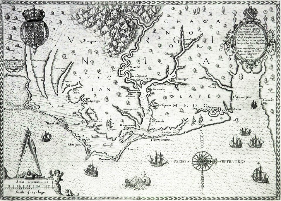
The William P. Cummings Map Society is located in North Carolina and has an informative blog with map news and local events.
Our wonderful neighbors to the northeast.
The California Map Society was founded in 1978 and has a website with many links of interest to map lovers.
A great map blog from the Library of Congress.
Source of map displayed on homepage: Damerum, William, and Peter Maverick. Map of the southern part of the state of New York including Long Island, the Sound, the state of Connecticut, part of the state of New Jersey, and islands adjacent: compiled from actual late surveys. New York: Wm. Damerum, 1815. Map. Retrieved from the Library of Congress, https://www.loc.gov/item/97683279/. (Accessed December 05, 2016.)
